National Register of Historic Places listings in Morgan County, Ohio

This is a list of the National Register of Historic Places listings in Morgan County, Ohio.
It is intended to be a complete list of the properties and districts on the National Register of Historic Places in Morgan County, Ohio, United States. The locations of National Register properties and districts for which the latitude and longitude coordinates are included below, may be seen in a Google map.[1]
There are 6 properties and districts listed on the National Register in the county. Another property was once listed but has been removed.
This National Park Service list is complete through NPS recent listings posted June 14, 2024.[2]
Map all coordinates using OpenStreetMap
Download coordinates as:
- KML
- GPX (all coordinates)
- GPX (primary coordinates)
- GPX (secondary coordinates)
Current listings
| [3] | Name on the Register[4] | Image | Date listed[5] | Location | City or town | Description |
|---|---|---|---|---|---|---|
| 1 | Adams Covered Bridge |  | February 5, 1999 (#99000093) | San Toy Rd., west of Malta 39°37′28″N 82°01′56″W / 39.624444°N 82.032222°W / 39.624444; -82.032222 (Adams Covered Bridge) | Union Township | |
| 2 | Barkhurst Mill Covered Bridge |  | February 5, 1999 (#99000097) | Township Road 21 over Wolf Creek, northeast of Chesterhill 39°30′10″N 81°50′03″W / 39.502778°N 81.834097°W / 39.502778; -81.834097 (Barkhurst Mill Covered Bridge) | Marion Township | |
| 3 | Big Bottom Massacre Site | 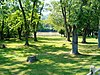 | November 10, 1970 (#70000512) | 1 mile southeast of Stockport on State Route 266 39°31′58″N 81°46′26″W / 39.532778°N 81.773889°W / 39.532778; -81.773889 (Big Bottom Massacre Site) | Windsor Township | |
| 4 | Helmick Mill Covered Bridge |  | February 5, 1999 (#99000098) | Township Road 269 over Island Run, northwest of Malta 39°43′11″N 81°56′32″W / 39.719722°N 81.942222°W / 39.719722; -81.942222 (Helmick Mill Covered Bridge) | Deerfield Township | |
| 5 | McConnelsville Historic District |  | June 14, 1979 (#79001906) | State Routes 78 and State Route 376 39°38′57″N 81°51′09″W / 39.649167°N 81.8525°W / 39.649167; -81.8525 (McConnelsville Historic District) | McConnelsville | |
| 6 | Muskingum River Navigation Historic District |  | February 9, 2007 (#07000025) | Coshocton, Muskingum, Morgan, Washington Counties 39°38′35″N 81°50′47″W / 39.643056°N 81.846389°W / 39.643056; -81.846389 (Muskingum River Navigation Historic District) | Numerous jurisdictions |
Former listing
| [3] | Name on the Register | Image | Date listed | Date removed | Location | City or town | Description |
|---|---|---|---|---|---|---|---|
| 1 | Rock Hollow School | Upload image | January 11, 1983 (#83002014) | January 31, 1995 | South of Ringgold on State Route 78 39°33′43″N 81°58′52″W / 39.5619°N 81.9811°W / 39.5619; -81.9811 (Rock Hollow School) | Ringgold |
See also
Wikimedia Commons has media related to National Register of Historic Places in Morgan County, Ohio.
- List of National Historic Landmarks in Ohio
- Listings in neighboring counties: Athens, Muskingum, Noble, Perry, Washington
- National Register of Historic Places listings in Ohio
References
- ^ The latitude and longitude information provided in this table was derived originally from the National Register Information System, which has been found to be fairly accurate for about 99% of listings. Some locations in this table may have been corrected to current GPS standards.
- ^ National Park Service, United States Department of the Interior, "National Register of Historic Places: Weekly List Actions", retrieved June 14, 2024.
- ^ a b Numbers represent an alphabetical ordering by significant words. Various colorings, defined here, differentiate National Historic Landmarks and historic districts from other NRHP buildings, structures, sites or objects.
- ^ "National Register Information System". National Register of Historic Places. National Park Service. April 24, 2008.
- ^ The eight-digit number below each date is the number assigned to each location in the National Register Information System database, which can be viewed by clicking the number.
- v
- t
- e
by county
- Adams
- Allen
- Ashland
- Ashtabula
- Athens
- Auglaize
- Belmont
- Brown
- Butler
- Carroll
- Champaign
- Clark
- Clermont
- Clinton
- Columbiana
- Coshocton
- Crawford
- Cuyahoga
- Darke
- Defiance
- Delaware
- Erie
- Fairfield
- Fayette
- Franklin
- Fulton
- Gallia
- Geauga
- Greene
- Guernsey
- Hamilton
- Hancock
- Hardin
- Harrison
- Henry
- Highland
- Hocking
- Holmes
- Huron
- Jackson
- Jefferson
- Knox
- Lake
- Lawrence
- Licking
- Logan
- Lorain
- Lucas
- Madison
- Mahoning
- Marion
- Medina
- Meigs
- Mercer
- Miami
- Monroe
- Montgomery
- Morgan
- Morrow
- Muskingum
- Noble
- Ottawa
- Paulding
- Perry
- Pickaway
- Pike
- Portage
- Preble
- Putnam
- Richland
- Ross
- Sandusky
- Scioto
- Seneca
- Shelby
- Stark
- Summit
- Trumbull
- Tuscarawas
- Union
- Van Wert
- Vinton
- Warren
- Washington
- Wayne
- Williams
- Wood
- Wyandot

Municipalities and communities of Morgan County, Ohio, United States | ||
|---|---|---|
County seat: McConnelsville | ||
| Villages |  | |
| Townships | ||
| CDP | ||
| Other unincorporated communities | ||
| Footnotes | ‡This populated place also has portions in an adjacent county or counties. | |
| ||


