Spokane Creek, Montana
Census-designated place in Montana, United States
46°32′43″N 111°44′47″W / 46.54528°N 111.74639°W / 46.54528; -111.74639 (2020)
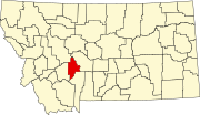
Spokane Creek is a census-designated place (CDP) in Broadwater County, Montana, United States. The population was 355 at the 2010 census.[3]
Geography
Radersburg is located in the northwest corner of Broadwater County, 14 miles (23 km) east of Helena, the state capital. 12/287 runs through the CDP, leading west to Helena and southeast 19 miles (31 km) to Townsend. Canyon Ferry Lake, a reservoir on the Missouri River, is 3 miles (5 km) to the east of the CDP.
According to the United States Census Bureau, the CDP has a total area of 17.3 square miles (44.8 km2), all land.[3]
Demographics
| Census | Pop. | Note | %± |
|---|---|---|---|
| 2020 | 430 | — | |
| U.S. Decennial Census[4] | |||
References
- ^ "ArcGIS REST Services Directory". United States Census Bureau. Retrieved September 5, 2022.
- ^ a b U.S. Geological Survey Geographic Names Information System: Spokane Creek, Montana
- ^ a b "Geographic Identifiers: 2010 Demographic Profile Data (G001): Spokane Creek CDP, Montana". U.S. Census Bureau, American Factfinder. Archived from the original on February 12, 2020. Retrieved June 26, 2013.
- ^ "Census of Population and Housing". Census.gov. Retrieved June 4, 2016.