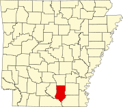
List of lakes of Bradley County, Arkansas
Map all coordinates using OpenStreetMap
Download coordinates as:
- KML
- GPX (all coordinates)
- GPX (primary coordinates)
- GPX (secondary coordinates)
There are at least 24 named lakes and reservoirs in Bradley County, Arkansas.
Lakes
- Bend Lake, 33°12′53″N 092°10′18″W / 33.21472°N 92.17167°W / 33.21472; -92.17167 (Bend Lake), el. 75 feet (23 m) [1]
- Bilbo Lake, 33°18′02″N 092°18′52″W / 33.30056°N 92.31444°W / 33.30056; -92.31444 (Bilbo Lake), el. 72 feet (22 m) [2]
- Black Lake, 33°21′09″N 091°58′25″W / 33.35250°N 91.97361°W / 33.35250; -91.97361 (Black Lake), el. 89 feet (27 m) [3]
- Black Lake, 33°15′48″N 092°03′12″W / 33.26333°N 92.05333°W / 33.26333; -92.05333 (Black Lake), el. 75 feet (23 m) [4]
- Buck Lake, 33°13′28″N 092°10′56″W / 33.22444°N 92.18222°W / 33.22444; -92.18222 (Buck Lake), el. 75 feet (23 m) [5]
- Eagle Lake, 33°14′21″N 092°09′46″W / 33.23917°N 92.16278°W / 33.23917; -92.16278 (Eagle Lake), el. 75 feet (23 m) [6]
- Frank Lake, 33°13′01″N 092°09′00″W / 33.21694°N 92.15000°W / 33.21694; -92.15000 (Frank Lake), el. 75 feet (23 m) [7]
- Gar Lake, 33°16′57″N 092°14′20″W / 33.28250°N 92.23889°W / 33.28250; -92.23889 (Gar Lake), el. 75 feet (23 m) [8]
- Green Lake, 33°17′21″N 092°16′26″W / 33.28917°N 92.27389°W / 33.28917; -92.27389 (Green Lake), el. 72 feet (22 m) [9]
- Middle Lake, 33°13′43″N 092°09′24″W / 33.22861°N 92.15667°W / 33.22861; -92.15667 (Middle Lake), el. 72 feet (22 m) [10]
- Moro Bay, 33°18′15″N 092°21′16″W / 33.30417°N 92.35444°W / 33.30417; -92.35444 (Moro Bay), el. 79 feet (24 m) [11]
- Mud Lake, 33°14′02″N 092°13′36″W / 33.23389°N 92.22667°W / 33.23389; -92.22667 (Mud Lake), el. 69 feet (21 m) [12]
- Pereogeethe Lake, 33°14′23″N 092°12′26″W / 33.23972°N 92.20722°W / 33.23972; -92.20722 (Pereogeethe Lake), el. 62 feet (19 m) [13]
- Pine Prairie Bay, 33°15′25″N 092°14′30″W / 33.25694°N 92.24167°W / 33.25694; -92.24167 (Pine Prairie Bay), el. 62 feet (19 m) [14]
- Raymond Lake, 33°17′47″N 092°20′04″W / 33.29639°N 92.33444°W / 33.29639; -92.33444 (Raymond Lake), el. 72 feet (22 m) [15]
- Scott Water, 33°41′51″N 092°19′41″W / 33.69750°N 92.32806°W / 33.69750; -92.32806 (Scott Water), el. 151 feet (46 m) [16]
- Straight Lake, 33°13′21″N 092°10′32″W / 33.22250°N 92.17556°W / 33.22250; -92.17556 (Straight Lake), el. 72 feet (22 m) [17]
- White Oak Lake, 33°16′14″N 092°09′45″W / 33.27056°N 92.16250°W / 33.27056; -92.16250 (White Oak Lake), el. 72 feet (22 m) [18]
Reservoirs
- Atkins Pond, 33°35′56″N 092°02′48″W / 33.59889°N 92.04667°W / 33.59889; -92.04667 (Atkins Pond), el. 164 feet (50 m) [19]
- Bradley County Lake, 33°37′24″N 092°05′46″W / 33.62333°N 92.09611°W / 33.62333; -92.09611 (Bradley County Lake), el. 230 feet (70 m) [20]
- Fullerton Lake, 33°38′21″N 092°01′51″W / 33.63917°N 92.03083°W / 33.63917; -92.03083 (Fullerton Lake), el. 135 feet (41 m) [21]
- Reeps Lake, 33°36′14″N 092°02′35″W / 33.60389°N 92.04306°W / 33.60389; -92.04306 (Reeps Lake), el. 144 feet (44 m) [22]
- Scott Lake, 33°38′09″N 092°03′10″W / 33.63583°N 92.05278°W / 33.63583; -92.05278 (Scott Lake), el. 161 feet (49 m) [23]
- Warren Country Club Lake, 33°34′11″N 092°04′01″W / 33.56972°N 92.06694°W / 33.56972; -92.06694 (Warren Country Club Lake), el. 177 feet (54 m) [24]
See also
Notes
- ^ "Bend Lake". Geographic Names Information System. United States Geological Survey, United States Department of the Interior.
- ^ "Bilbo Lake". Geographic Names Information System. United States Geological Survey, United States Department of the Interior.
- ^ "Black Lake". Geographic Names Information System. United States Geological Survey, United States Department of the Interior.
- ^ "Black Lake". Geographic Names Information System. United States Geological Survey, United States Department of the Interior.
- ^ "Buck Lake". Geographic Names Information System. United States Geological Survey, United States Department of the Interior.
- ^ "Eagle Lake". Geographic Names Information System. United States Geological Survey, United States Department of the Interior.
- ^ "Frank Lake". Geographic Names Information System. United States Geological Survey, United States Department of the Interior.
- ^ "Gar Lake". Geographic Names Information System. United States Geological Survey, United States Department of the Interior.
- ^ "Green Lake". Geographic Names Information System. United States Geological Survey, United States Department of the Interior.
- ^ "Middle Lake". Geographic Names Information System. United States Geological Survey, United States Department of the Interior.
- ^ "Moro Bay". Geographic Names Information System. United States Geological Survey, United States Department of the Interior.
- ^ "Mud Lake". Geographic Names Information System. United States Geological Survey, United States Department of the Interior.
- ^ "Pereogeethe Lake". Geographic Names Information System. United States Geological Survey, United States Department of the Interior.
- ^ "Pine Prairie Bay". Geographic Names Information System. United States Geological Survey, United States Department of the Interior.
- ^ "Raymond Lake". Geographic Names Information System. United States Geological Survey, United States Department of the Interior.
- ^ "Scott Water". Geographic Names Information System. United States Geological Survey, United States Department of the Interior.
- ^ "Straight Lake". Geographic Names Information System. United States Geological Survey, United States Department of the Interior.
- ^ "White Oak Lake". Geographic Names Information System. United States Geological Survey, United States Department of the Interior.
- ^ "Atkins Pond". Geographic Names Information System. United States Geological Survey, United States Department of the Interior.
- ^ "Bradley County Lake". Geographic Names Information System. United States Geological Survey, United States Department of the Interior.
- ^ "Fullerton Lake". Geographic Names Information System. United States Geological Survey, United States Department of the Interior.
- ^ "Reeps Lake". Geographic Names Information System. United States Geological Survey, United States Department of the Interior.
- ^ "Scott Lake". Geographic Names Information System. United States Geological Survey, United States Department of the Interior.
- ^ "Warren Country Club Lake". Geographic Names Information System. United States Geological Survey, United States Department of the Interior.