Antanimbary
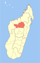
Place in Betsiboka, Madagascar
17°11′S 46°51′E / 17.183°S 46.850°E / -17.183; 46.850 Madagascar
 (2001)[2]
Antanimbary is a town and commune (Malagasy: kaominina) in Madagascar. It belongs to the district of Maevatanana, which is a part of Betsiboka Region. The population of the commune was estimated to be approximately 3,000 in 2001 commune census.[2]
Antanimbary has a riverine harbour. Only primary schooling is available. The majority 60% of the population of the commune are farmers, while an additional 25% receives their livelihood from raising livestock. The most important crops are rice and raffia palm, while other important agricultural products are cassava and sweet potatoes. Services provide employment for 5% of the population. Additionally fishing employs 10% of the population.[2]
Infrastructure
- Route Nationale 4 from Antananarivo to Mahajanga.
References and notes
- ^ Estimated based on DEM data from Shuttle Radar Topography Mission
- ^ a b c "ILO census data". Cornell University. 2002. Retrieved 2008-03-05.
- v
- t
- e
Capital: Maevatanana
3 districts; 32 communes
17°11′S 46°51′E / 17.183°S 46.850°E / -17.183; 46.850
 | This Betsiboka location article is a stub. You can help Wikipedia by expanding it. |
- v
- t
- e


